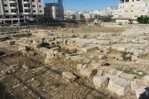
The site where Jonathan killed 20 Philistines - Identifying biblical sites, Part 1
Events in the Bible happened in real locations, many of which can still be identified

Some biblical stories remain unknown or unclear to many Christians and Jews, particularly regarding their exact geographical locations.
Often, the obscure names of the places mentioned are not easily understood, and it is uncertain whether these places can be identified with current locations.
However, there are numerous answers to these questions that every Christian or Jew can ponder.
Some of these types of questions may be: Where is the ancient city of Ai? Gilgal? Gibeon? Where are the rocks of Seneh and Bozez?
Visualizing the locations mentioned in biblical stories can help in better understanding them.
Numerous biblical events took place at real geographical sites, many of which can still be identified today, as most conservative Christian and Jewish scholars believe the Bible to be a genuine and true source of historical events and sites.
For example, the event of Jonathan fighting a Philistine garrison with his servant took place near two legendary rocks called Seneh and Bozez. These rocks are known and located in the Michmash River Bed in the Benjamin region (modern-day Samaria), internationally known as the West Bank.
Indeed, at the entrance of the Michmash canyon, two prominent rocks jut out at the point where the stream turns into a narrow and rugged canyon. They correspond perfectly with the biblical description.
In the first Book of Samuel, chapter 14, the Bozez (Botsets) and Seneh rocks are mentioned in a very defined and specific geographical context (King James Version (KJV)).
4 And between the passages, by which Jonathan sought to go over unto the Philistines' garrison, there was a sharp rock on the one side, and a sharp rock on the other side: and the name of the one was Bozez, and the name of the other Seneh.
5 The forefront of the one was situated northward over against Michmash, and the other southward over against Gibeah.
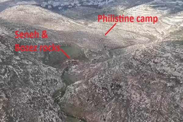
According to the Bible, King Saul’s son Jonathan, along with his armor-bearer, planned to attack a Philistine garrison believing that God would save them regardless of their numbers. They revealed themselves to the Philistines, who invited them to come up. Taking this as a sign from God, they climbed up and defeated about 20 Philistines in a small area of the camp.
The identification of the site has been determined by scholars considering both geographical and historical contexts. The two rocks are situated precisely on either side of the canyon, located between the modern Palestinian villages of Jaba (ancient Gibeah) and Mukhamas (ancient Michmash).
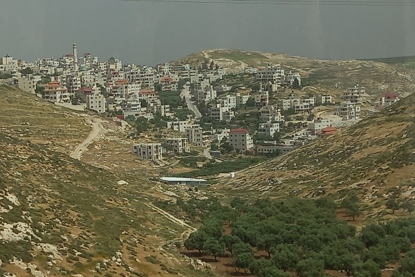
Like many other places in the Holy Land, these ancient Arab villages and cities retained their ancient Hebrew names from the biblical period onwards. The rocks are also approximately 2.5 kilometers (1.55 miles) as the crow flies from Migron.
Adjacent to the rocks, ancient walls have been discovered, potentially belonging to the Philistine camp mentioned in 1 Samuel 14, further supporting the site's identification.
Michmash Stream (Arabic: Wadi Suweinit) is a tributary of the Jordan River. It descends from the modern Palestinian city of Ramallah and flows into the Jordan River near the village of Adummim, spanning about 20 kilometers (12.42 miles). The stream forms a significant canyon crossing the upper slope of the Judean Desert, with several springs along its course, and is named after the biblical settlement of Michmash.
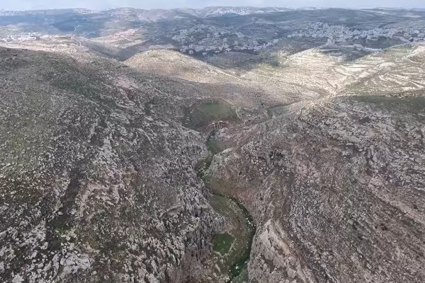
Bozez (בוצץ Botsets in Hebrew) is the northern rock. Jewish biblical commentator Radak believes its Hebrew name means "shining wall" (or shining platform). This rock, located on the southern slope, is mostly illuminated throughout the day in contrast to Seneh, and its name likely relates to this, being similiar to the word "Notsets" which means "shining." This is also reflected in the Jewish religious text of the Tosefta (Mikvaot 1:6), which mentions "the mountains are shining" after rainfall.
Seneh (סנה in Hebrew) is the southern rock and is on a steep northern slope and remains shaded for most of the day. The Radak believes its name means "steep place." Another suggestion is that the name refers to an acacia tree, which may also be the origin of the canyon's Arabic name: Wadi Suweinit.
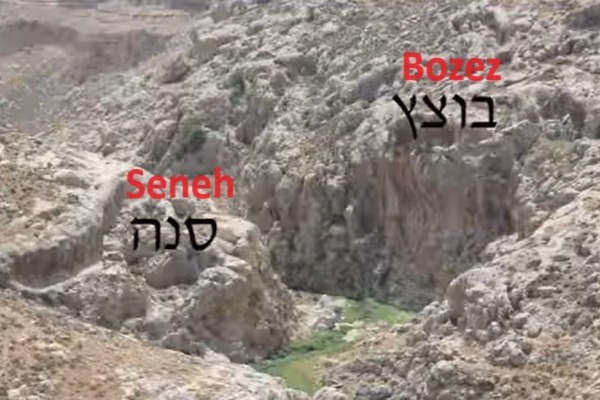
When studying the biblical history and geography of Israel, sometimes all it takes to gain understanding is to visit and rediscover sites left as they were during antiquity. The geography remains largely unchanged, with some ancient names persisting over time, occasionally undergoing slight changes or adaptations.
It seems the Philistine military presence was significant in the region until the collapse of the Philistine kingdoms and the hegemony of the kingdom of Israel under the reign of King David in the 10th century B.C. The Bible mentions several times that Philistine armies penetrated deeply into the territory of the Israelite tribes, reaching as far north as Mount Gilboa and even to Beth-Shean and the hills of Ephraim (Samaria).
This presence was likely strategic, with fortified camps aimed at better controlling the passages and the local Hebrew population. The Philistine presence among the Israelite cities and villages is sometimes recorded in modern archaeology, with Philistine pottery found at the Israelite sites.
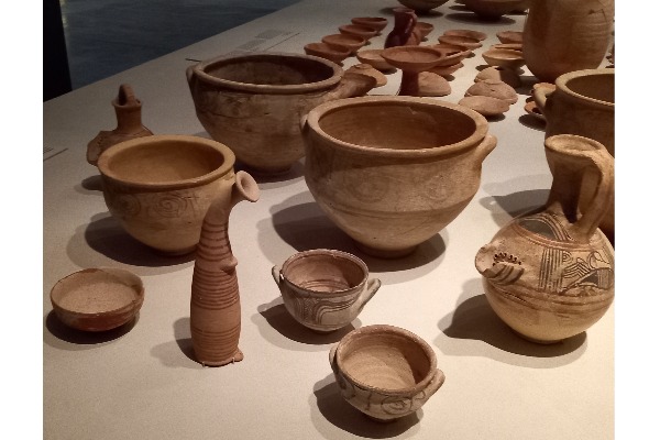
As indicated in the Book of Joshua 13:3, five main ancient sites associated with the ancient Philistines can be identified today in the archaeology of the Holy Land: Gaza, Ashkelon, Ashdod, Gath (Tell Es-Safi), and Ekron.
The yoke of the Philistines on the Israelites was at such a scale before the rise of King David, that the Israelites wouldn’t be allowed to make metal weapons:
"Now there was no smith found throughout all the land of Israel: for the Philistines said, Lest the Hebrews make them swords or spears" (1 Samuel 13:19).
It appears the killing of the Philistine garrison near the rock of Seneh and Bozez was the beginning of a breakthrough for the Israelites, which led to a total liberation and victory of the Kingdom of Israel over his enemies under the next king, the young King David.
Interestingly, some believe that in 1917, the British army used the same path Jonathan took according to the Bible, to defeat the Turks in that very spot.
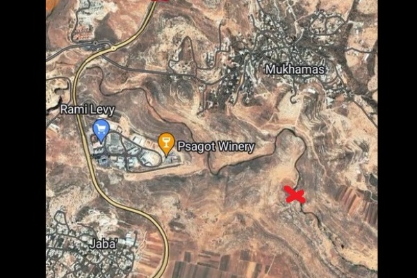
Access to this stream is by foot only, via a dirt road branching off from the access road to the "Bnei Adam" neighborhood of the Israeli village of Adam. The site is open 24 hours a day with free entry. Visitors should comply with local Israeli laws and security regulations of the Israeli army, as the area is situated between Palestinian villages in the Samaria region.
The Seneh and Bozez site can be viewed from the cliffs at the start of an Israeli route marked with black trail markers, northeast of the modern Israeli village of Geva Binyamin (Adam).

Aaron Goel-Angot is a Belgian-Israeli archaeologist with an expertise in antiquities identification. He is an enthusiastic numismatist and a licensed tour guide. He holds a BA degree in archaeology from the Institute of Archaeology at the Hebrew University of Jerusalem. He joined the ALL ISRAEL NEWS team as an Archaeology and Tourism correspondent. Aaron is married, father of three young children and lives in Jerusalem.
You might also like to read this:


